Atlanta Travel Guide
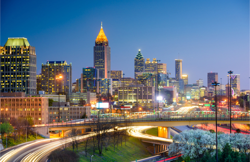
As anyone who has watched the extraordinary career of Stacey Abrams knows, Atlanta, and the state of Georgia, has come a long way since the Civil War era. These days Atlantans are as likely to have moved here from elsewhere as to be born Southerners. The culture of this diverse New South metropolis reveals itself at the High Museum of Art, the bohemian shops of Little Five Points and the international dining scene found along Buford Highway. But don't worry, there are still plenty of places to eat grits.
Things to Do
Discover the inventor of the 24-hour news cycle on a tour of CNN, where guides give behind-the-scenes tours of studios and let guests record their own newscasts. While modern Atlanta reports the news these days, the city has contributed many chapters to American history. Its most powerful historic site is the Martin Luther King Jr. National Historic Site, with Rev. King's boyhood home, Ebenezer Baptist Church, and his tomb engraved, "Free at last, Free at last, Thank God Almighty, I'm Free at last." Pair a visit to those two with a tour through the extraordinary National Center for Human and Civil Rights, one of the finest history and culture museums in the country. Also try to make time for the Atlanta History Center, a multifaceted cultural campus that includes historic homes, superb museum exhibits, and the famed Cyclorama.
Shopping
Go to the Atlanta neighborhood of Buckhead for trendsetter labels like Giorgio Armani and Zara. Just south of Buckhead is Bennett Street, a former warehouse district now converted into galleries and shops specializing in art, decorative accessories and antiques. For a little something edgier, Atlantans head for the boutiques of Virginia Highland, where chunky jewelry, bohemian dresses and the latest boots fill shop windows.
Nightlife and Entertainment
When the temperatures rise -- and they rise early in Atlanta -- there's no better place to catch a cool breeze than from a rooftop bar in Midtown. Atlantans love to party. Shout and F.A.B. are trendy mainstays, while Flip Flops attracts a younger crowd for cocktails and dancing. From April through September the Atlanta Braves play baseball at Turner Field. It's worthwhile to arrive early for a tour, playtime at the Tooner Field playground or a visit to the ballpark's museum.
Restaurants and Dining
Grits and sweet tea are traditions of a Southern diet, and no one makes them better than Mary Mac's Tea Room. This sprawling restaurant serves fluffy buttermilk biscuits and fried chicken. First-timers get a free cup of pot likker soup, made from the stock of boiled collard greens. Look for lighter fare at The Optimist, where Southern traditions meet a global palate. For a truly international experience, head for Buford Highway. Family-owned restaurants along this stretch serve authentic foods from Venezuela, Vietnam and Korea.