Robert Harding Video / Shutterstock
San Francisco Travel Guide
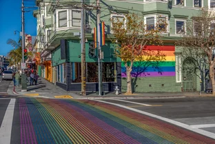
San Francisco’s reputation as a rollicking city where almost anything goes dates back to the boom-or-bust days of the California gold rush. It’s always been this way: This city is so beautiful, so exciting and diverse, and so cosmopolitan that you can always find something new to see and do no matter if it’s your 1st or 50th visit. Oh, and bring a warm jacket: Bob Hope once remarked that San Francisco is the city of four seasons—every day.
Things to Do
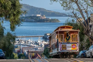
Consistently ranked as America's Favorite City, San Francisco never ceases to entertain. Enjoy the cool blast of salty air as you stroll across the Golden Gate. Stuff yourself with dim sum in Chinatown. Browse the secondhand shops along Haight Street. Recite poetry in a North Beach coffeehouse. Stroll Ocean Beach, skate through Golden Gate Park, ride the cable cars to Fisherman's Wharf, tour a Victorian mansion, explore Alcatraz Island, go to a Giants ball game—the list is endless.
Shopping
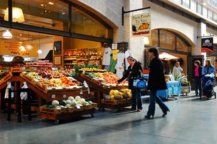
Oh baby, start polishing that credit card. Some of our favorites include strolling the hip boutiques in Hayes Valley, gourmet delicacies at the Ferry Building Marketplace, the wow factor of Union Square and Westfield San Francisco Centre, real vinyl records on Haight Street, and the weird-to-wonderful shopping bazaar that is Chinatown.
Nightlife & Entertainment
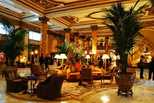
It's true: San Francisco sells more theater tickets per capita than any major city in America. We love to watch our recycled Broadway musicals at the A.C.T. and transgender tragedies at Theatre Rhinoceros. The San Francisco Symphony, Opera, and Ballet are three great reasons to dress up. Sunday's a Drag (show) at Harry Denton's Starlight Room, while anything goes down at the EndUp. Stanton Moore is at the Boom Boom Room, and Tainted Love is sold out at Bimbo's 365 Club. Let's end the night with a Golden Gate Martini at Top of the Mark.
Restaurants & Dining
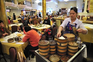
With more than 4,415 restaurants in San Francisco, you could eat at a different restaurant every night for 10 years and still not visit them all. Try Afghan, Burmese, Cambodian, Cajun, Moroccan, Persian, Ethiopian—or better yet, follow the street food craze at RoamingHunger.com/sf in search of Sam's Chowder Mobile, the Chairman, and Waffle Mania food trucks.