

Kristin Mills
Here's how you can see Oahu, Molokai, Lanai, the Big Island, and Kauai's best natural sights on foot.
Photo Caption: Hikers can climb 11 miles into a dormant volcano on Maui's Sliding Sands Trail in Haleakala National Park.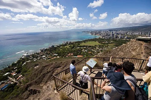 This is a moderate, but steep, walk to the summit of the 750-foot volcanic cone, Hawaii's most famous landmark, with a reward of a 360-degree view of the island. The 1.4-mile round-trip takes about 1½ hours. The entry fee is $1. Wear decent shoes (rubber-soled tennies are fine), and take a flashlight (you'll walk through several dark tunnels), binoculars (for better viewing at the top), water, a hat to protect you from the sun, and a camera. You might want to put all your gear in a pack to leave your hands free for the climb. Go early, preferably just after the 6:30am opening, before the midday sun starts beating down.
Photo Caption: You have to pay a $1 fee to climb the 1.4 miles to the top of Diamond Head, but the view from the 750-foot summit is priceless.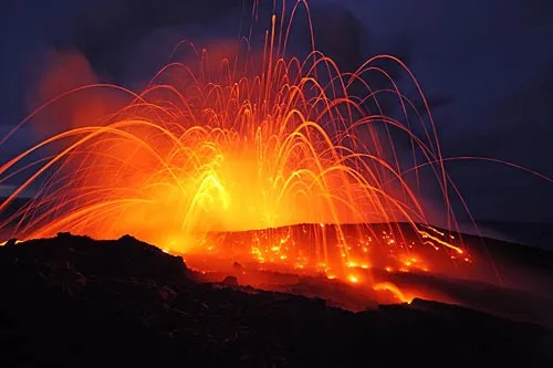 Up on the rim of Kilauea Iki Crater, you can see what an erupting volcano did to a once-flourishing ohia forest. The scorched earth, with its ghostly tree skeletons, lies in sharp contrast to the rest of the lush forest. Everyone can take this .5-mile hike on a paved path across the eerie bed of black cinders. The trail head is on Crater Rim Road at Puu Puai Overlook.
Photo Caption: The Big Island's best-known attraction is Hawaii Volcanoes National Park, where you can witness Pele's spectacular natural fireworks.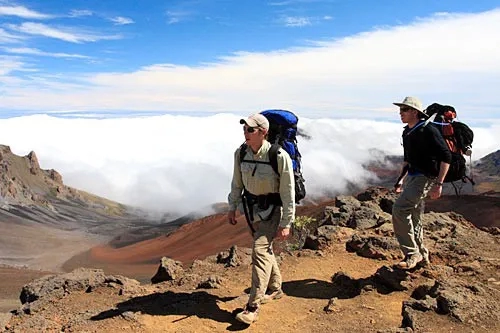 Hiking into Maui's dormant volcano is really the best way to see it. The terrain inside the wilderness area of the volcano, which ranges from burnt-red cinder cones to ebony-black lava flows, is simply spectacular. The best route takes in two trails: head into the crater along Sliding Sands Trail, which begins on the rim at 9,800 feet and descends into the belly of the beast, to the valley floor at 6,600 feet, and back out along Halemauu Trail. Hardy hikers can consider making the 11-mile one-way descent, which takes 9 hours, and the equally long return ascent in 1 day. The rest of us will need to extend this steep but wonderful hike to 2 days.
Photo Caption: Scale a 10,000-foot dormant volcano and peek into the crater at Haleakala National Park.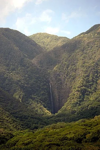 Of the five great valleys of Molokai, only Halawa, with its two waterfalls, golden beach, sleepy lagoon, great surf, and offshore island, is easily accessible. An easy hike will take you from the ocean to the foot of a waterfall. Pilipo Solotario and his family, who own the land in the valley, are the only people allowed to lead hikes into Halawa. They lead daily tours, which begin at the County Park pavilion, with a history of the valley, a discussion of the Hawaiian culture, and a display of the fruits, trees, and other flora you will be seeing in the valley. Along the hike, Solotario stops to point out historical and cultural aspects, including a sacred heiau. At the waterfalls visitors can swim in the brisk pool water. Contact Molokai Fish & Dive (tel. 808/553-5926; www.molokaifishanddive.com) for reservations.
Photo Caption: The majestic Halawa Falls cascade 250 feet down into the remote valley, which can only be reached by guided tour.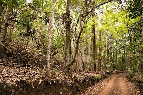 If it hasn't been raining and the ground is dry, do a little exploring. The adventurous will spend the day climbing to the top of Lanai at Lanaihale on the Munro Trail. This tough, 11-mile round-trip, uphill climb through the groves of Norfolk Island pines is a lung-buster, but if you reach the top, you'll be rewarded with a breathtaking view of Molokai, Maui, Kahoolawe, the peaks of the Big Island, and -- on a really clear day -- Oahu in the distance. Figure on 7 hours hiking. The trail follows Lanai's ancient caldera rim, ending up at the island's highest point, Lanaihale. Go in the morning for the best visibility. After 4 miles, you'll get a view of Lanai City. The weary retrace their steps from here, while the more determined go the last 1.25 miles to the top. Die- hards head down Lanai's steep south-crater rim to join the highway to Manele Bay. The not-so-adventurous will take a four-wheel-drive vehicle. Pencil in a soak in a hot tub on your return.
Photo Caption: The challenging Munro Trail takes you on an 11-mile trek to Lanai's highest point, where you'll be rewarded with an incredible view.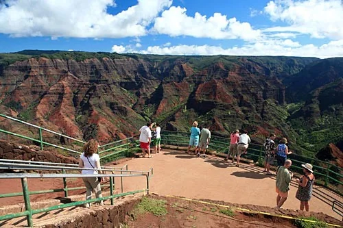
Photo Caption: Hikers can climb 11 miles into a dormant volcano on Maui's Sliding Sands Trail in Haleakala National Park.
Photo Caption: You have to pay a $1 fee to climb the 1.4 miles to the top of Diamond Head, but the view from the 750-foot summit is priceless.
Photo Caption: The Big Island's best-known attraction is Hawaii Volcanoes National Park, where you can witness Pele's spectacular natural fireworks.
Photo Caption: Scale a 10,000-foot dormant volcano and peek into the crater at Haleakala National Park.
Photo Caption: The majestic Halawa Falls cascade 250 feet down into the remote valley, which can only be reached by guided tour.
Photo Caption: The challenging Munro Trail takes you on an 11-mile trek to Lanai's highest point, where you'll be rewarded with an incredible view.