
Updated April 2, 2024
The Oregon Coast is about 364 miles long. The main artery, U.S. Highway 101, winds along the entire way, often with the ocean in view. On our leisurely weeklong itinerary, we’ll spend a lot of time on this mostly two-lane highway—though with frequent stops and detours to see migrating whales, wave-battered beaches, lonely lighthouses, majestic forests, and quiet villages.
Keep in mind that this isn’t the sun-and-surfing kind of coastal experience. The water’s too cold and the wind too fierce for swimming. And no matter what time of year you visit, you should bring rain gear. But don’t let that discourage you. The Oregon Coast makes up for its gray skies with an unbroken stretch of rugged splendors.
Driving distance: 26 miles
Our journey begins in Astoria, located at the mouth of the Columbia River about a two-hour drive west of Portland. After a stroll along the Riverwalk, head south about 5 miles to visit Fort Clatsop at Lewis and Clark National Historical Park, site of the 1805 winter headquarters of the trailblazing explorers Meriwether Lewis and William Clark and their Corps of Discovery.
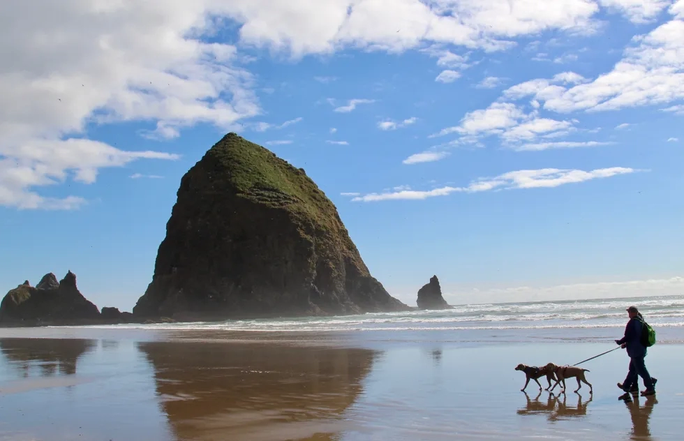
Then continue on to Cannon Beach, about 22 miles south of Astoria, to see Haystack Rock (pictured above) rising out of the sea amid miles of flat, sandy, surf-pounded beach. Squeeze in a visit to Ecola State Park at the north end of town for forested hiking trails with panoramic ocean views. Cannon Beach has numerous seaside hotels and restaurants to keep you pleasantly occupied during an overnight stay.
Driving distance: 109 miles
Continuing south from Cannon Beach on U.S. 101, in about 40 miles you’ll come to Tillamook, situated in a dairy region of lush green fields—don't pass up a chance to sample the area's output in the form of cheese or ice cream (or both). Just south of Tillamook, watch for the turnoff for the Three Capes Scenic Loop, a 35-mile circuit that takes you to three giant headlands where you can hike or simply gawk at spectacular viewpoints. Have lunch with a side of Pacific scenery in Oceanside before rejoining U.S. 101 in Pacific City.
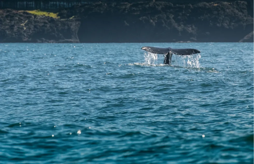
Driving another 45 minutes south will bring you to Depoe Bay (pictured above). In spring and summer, whale-watching boats chug out from the nation’s smallest harbor and into the open sea for possible sightings of 20-ton gray whales passing through during their annual migration. Back on solid ground, the Whale Watching Center will teach you more about these remarkable mammals.
Driving distance: 13 miles
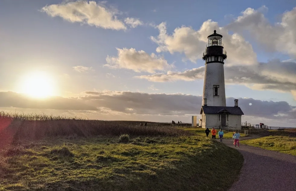
Make the busy town of Newport, located about 13 miles south of Depoe Bay, your base for day three. First, follow the signs for Yaquina Head Outstanding Natural Area to find the 1873 Yaquina Head Lighthouse (pictured above). The basalt headland here extends a mile into the sea, with a series of dramatic offshore rocks that serve as wildlife sanctuaries for seabirds and seals. A staircase leads down to a beach covered with stones worn smooth by the sea.
Around lunchtime, head to Newport’s Bayfront to find restaurants serving seafood caught only hours before by the commercial fishing fleets based here. Then make your way to Yaquina Bay State Recreation Site on the north side of the Yaquina Bay Bridge. Here stands the lighthouse that was put out of service by the beacon you saw earlier. This one is really just a two-story wooden house with a light fixed to the roof.
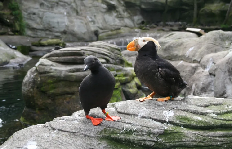
Newport has one of the most famous bridges on the Oregon coast—a long, graceful span designed by Conde McCullough in the 1930s. Cross the Yaquina Bay Bridge to reach the popular Oregon Coast Aquarium. You’ll pass through an outdoor aviary with tufted puffins (pictured above) and by outdoor pools with sea otters before reaching the fascinating tanks inside.
It’s been a full day, but what about a walk on the beach before dinner? The Nye Beach neighborhood is a good option for that. Many of the homes nearby date from the early 1900s, when Newport was one of the only resort towns on the Oregon coast.
Driving distance: 24 miles
From here to the California border, indoor tourist attractions thin out but the wild beauty of the landscape only intensifies. Twenty-four miles south of Newport on U.S. 101, the artsy and affluent village of Yachats (pronounced YAH-hots) has no commercial development to speak of, but with an oceanfront like this who wants commerce? The beach is marked by rocky coves and tide pools; agates frequently wash ashore after storms. At its southern end, the town is overshadowed by the towering bulk of Cape Perpetua, an 800-foot-tall headland and the highest point on the Oregon coast.
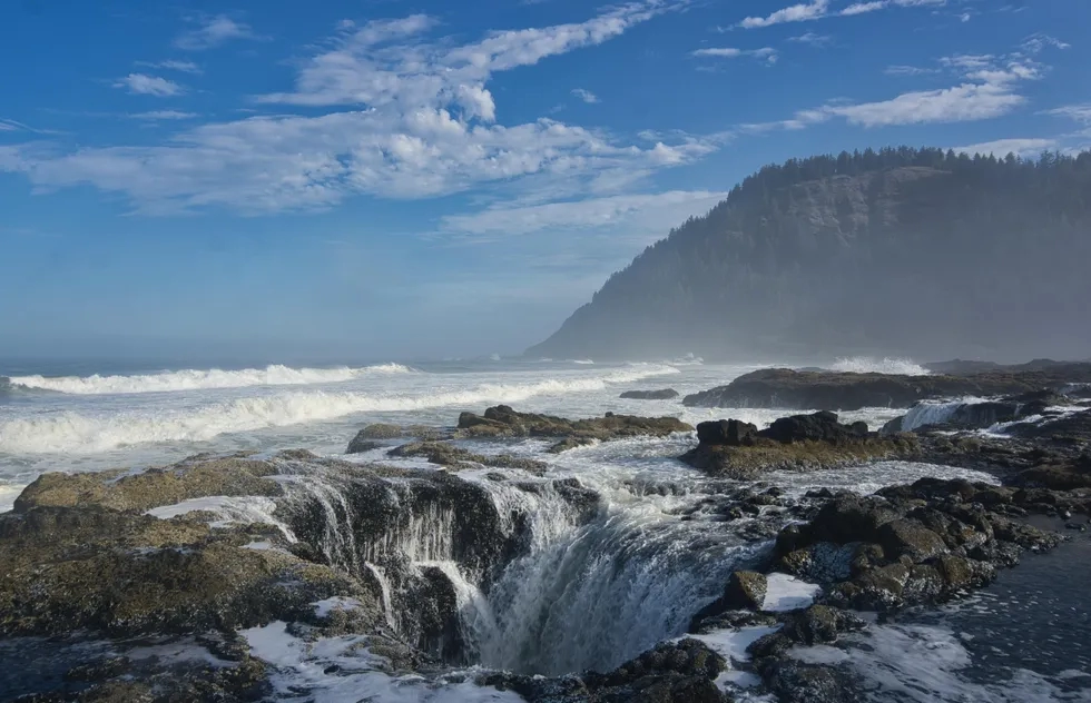
At the Cape Perpetua Scenic Area, you can hit hiking trails in old-growth forests, poke around in more shoreline tide pools, and marvel at wonders such as the seemingly bottomless Thor's Well sinkhole (pictured above) and Devils Churn, where the force of incoming waves into a narrow fissure sends geysers of seawater shooting high into the air. Back in Yachats, you’ll be pleased to discover an array of top-tier restaurants.
Driving distance: 25 miles
On the morning of day five, head south again, up and over Cape Perpetua, and keep your eyes peeled for Heceta Head Lighthouse State Scenic Viewpoint. The lighthouse sits at the edge of a rocky promontory above the crashing waves of the Pacific. Just a mile south is one of the Oregon coast’s most long-lived natural attractions, Sea Lion Caves. An elevator takes you down to a viewing window overlooking one of the largest sea lion rookeries on the West Coast.
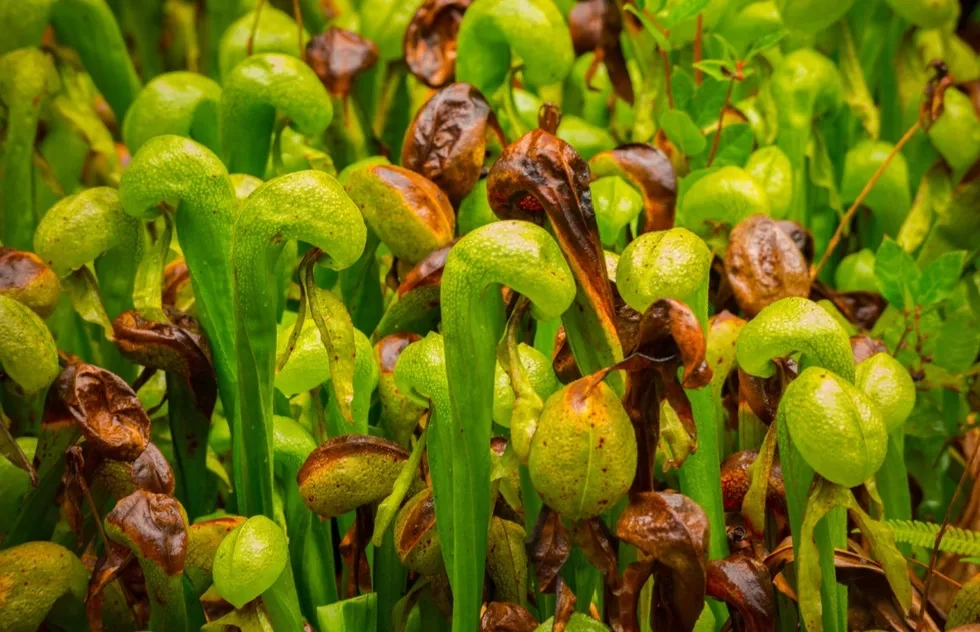
In another 6 miles, look for a highway sign marked Darlingtonia State Natural Site (pictured above). Although it’s very small, this little marshy area beside U.S. 101 is eerily beautiful. It’s home to an emerald-green field of rare insect-eating plants that look like thousands of eyeless cobras.
Your lunch stop is Florence, which got its start during the California Gold Rush, when timber and provisions were floated toward San Francisco via the Siuslaw River flowing right through the heart of town. The wooden storefronts along the waterside promenade give the place some real historical character.

Driving distance: 72 miles
Although there’s no official boundary line, the South Coast begins just south of Florence, and so does the Oregon Dunes National Recreation Area, a 50-mile swath of towering dunes between the shoreline and U.S. 101 ("sandboarding" on the dunes is pictured above). Next comes Coos Bay and then the turnoff for the Cape Arago Highway.
You may not want to stop at all three state parks on the route, but each has its charms. The first is Sunset Bay State Park, a sheltered cove beneath high sandstone cliffs. Shore Acres State Park offers the chance to visit a rose garden where you may hear seals barking in the distance. Those animals are also star attractions at Cape Arago State Park, where they hang out on offshore rocks that are part of the Oregon Islands National Wildlife Refuge. After you’ve visited one—or all—of the state parks, continue south on U.S. 101 to spend the night in Bandon.
Driving distance: 59 miles
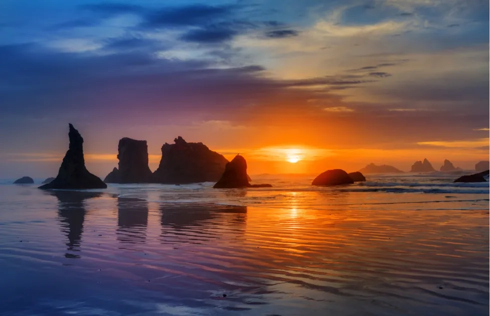
Golfers from all over the world descend on Bandon to play at the six renowned links courses at Bandon Dunes Golf Resort. But this coastal community, located where the Coquille River spills into the Pacific, was popular long before the duffers took over. The attractions may be gone from when passenger steamers stopped here on trips between San Francisco and Seattle, but the beach and rock formations (pictured above) remain awe-inspiring. Take the Beach Loop Drive to Bullards Beach State Park to see mighty monoliths with names based on what they look like: Face Rock, Table Rock, the Sisters, and Cat and Kittens. Also on the way: the octagonal Coquille River Lighthouse, dating from 1896.
Heading south from Bandon on U.S. 101, you’ll pass cranberry fields. Many of them are now part of huge corporate farming operations, but during the harvest season (mid-October to early December) some cranberry tours are available—and plenty of homemade cranberry jams and other products are for sale in town. Then it’s another 59 miles to Gold Beach, where the Rogue River empties into the sea.
Driving distance: 28 miles
A jet-boat trip up the Rogue is an exhilarating option for experiencing that waterway, but if you prefer less octane there are several excellent hiking options in the Gold Beach area. The easily walkable Frances Schrader Old Growth Trail takes you to a stand of giant trees; the Rogue River Trail traverses a scenic area above the water.
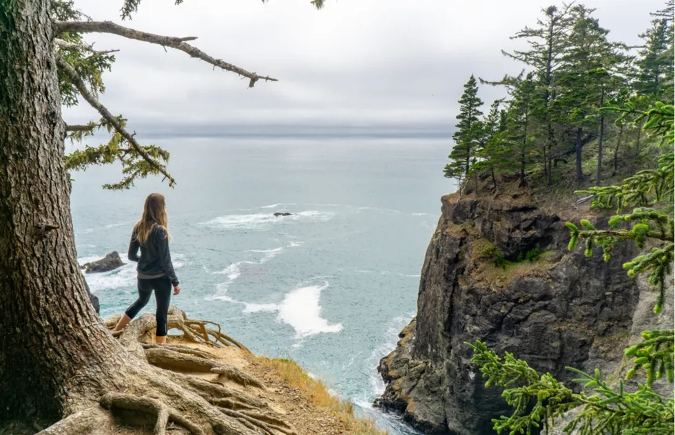
The 28-mile stretch between Gold Beach and Brookings is a scenic corridor with several pullouts and state parks (such as Samuel H. Boardman, pictured above) where you can stop to enjoy the view. This area of the South Coast is referred to as the "Banana Belt" of Oregon because the climate and somewhat sheltered topography foster the growth of semitropical plants. Most of the nation’s Easter lilies come from around here.
From Brookings, U.S. 101 continues across the California border, slithering down through even more incredible scenery—but that’s a road trip for another day.