

Before fridge magnets, before baseball caps, and even before miniature collectible spoons, there were maps.
Maps are the O.G. travel souvenir. In the pre-smartphone days, carrying a map was how you got to your destination and how you got around once you arrived. And although travel methods and spending trends have changed, nothing evokes a trip well-traveled better than a beautiful map.
These nine mapmakers have taken cartography to another level. When it's time to buy a special present for the travelers in your life, check out these highly personalized options that are unlikely to be duplicated.
We have no partnerships with these businesses and we make no money if you order any of these creations—we just think they look cool.
For more travel-inspired home décor: Follow Flights, Trains, Theme Park Rides, and More from Your Desk with These 14 Fun Live Trackers
Lichtbild
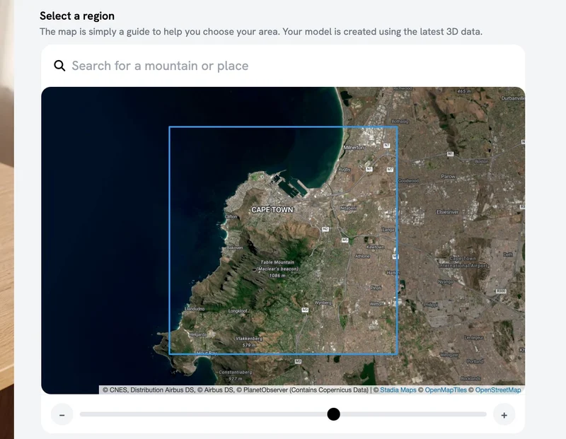
Based in Stuttgart, Germany, Lichtbild is a family business that turns your favorite section of your favorite city or landscape into a custom-printed 3D model derived from actual location geodata. (A model for Rome is pictured at the top of this post.)
You can even have a model made of your own neighborhood. Lichtbild's website allows customers to adjust the map to their preferred spot before ordering.
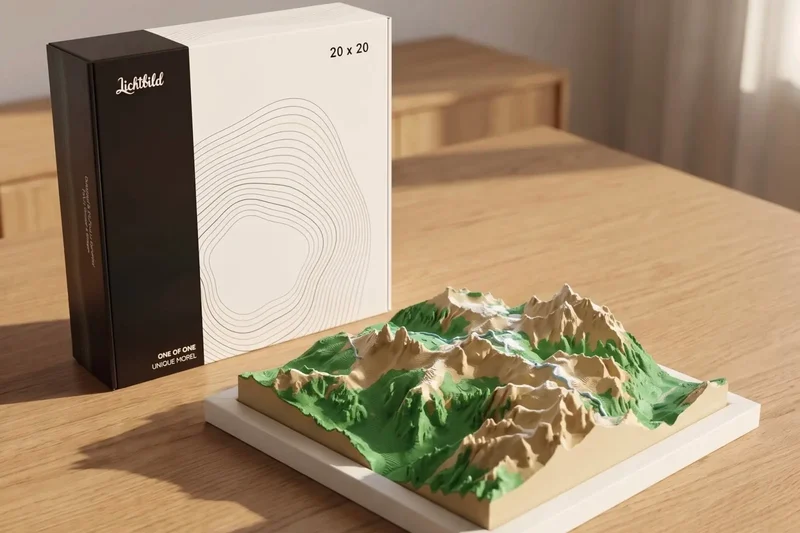
The finished dioramas include buildings, peaks, trees, and all the major landmarks, rendered either with simple maplike coloring or in classic white. Panels can be ordered as 7.9 inches square ($89), 10.2 inches square ($119), or made into continuous panoramas that combine squares into a mosaic ($349 for four panels).
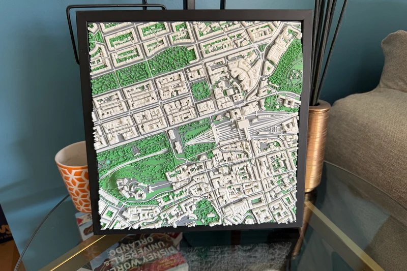
To make sure this product was something we could recommend to Frommer's readers, we ordered a model of Edinburgh, Scotland, a city full of slopes, monuments, and various terrains. The finished version (pictured above) turned out beautifully.
Muir Way
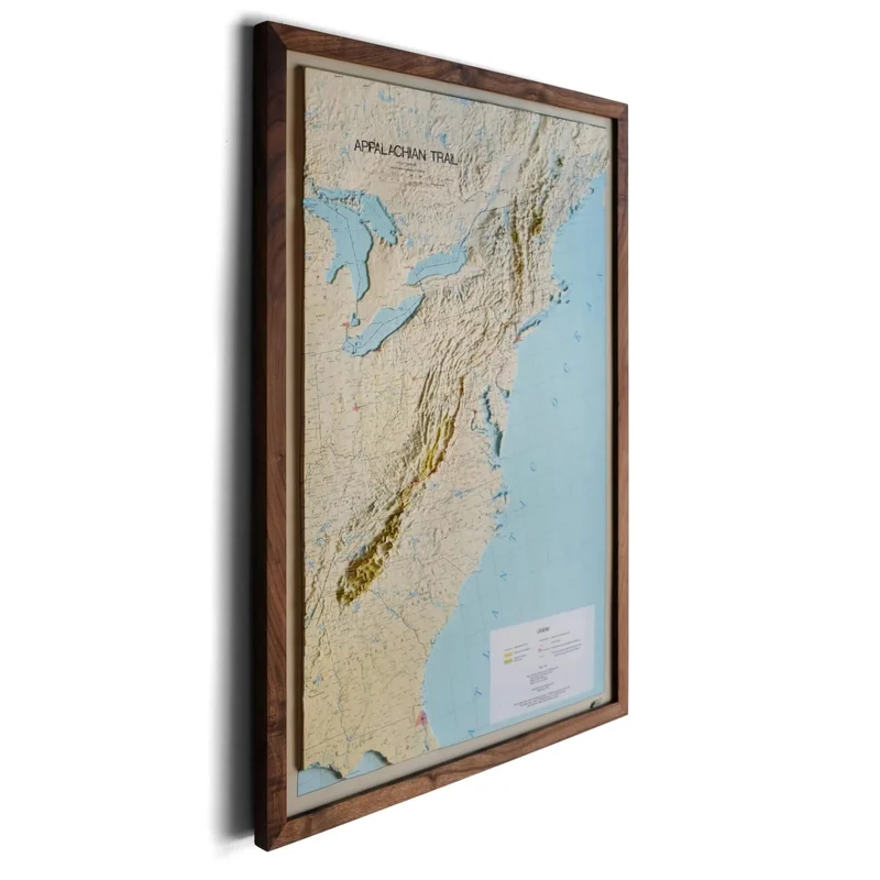
Muir Way's 3D Raised Relief Maps are another tactile option for turning a favorite place into art. "We print the map on plastic and thermoform it to a precisely cut mold to create the raised print," the company says. "We then cut the map and mount it onto foamboard to make a rigid map that you can display easily."
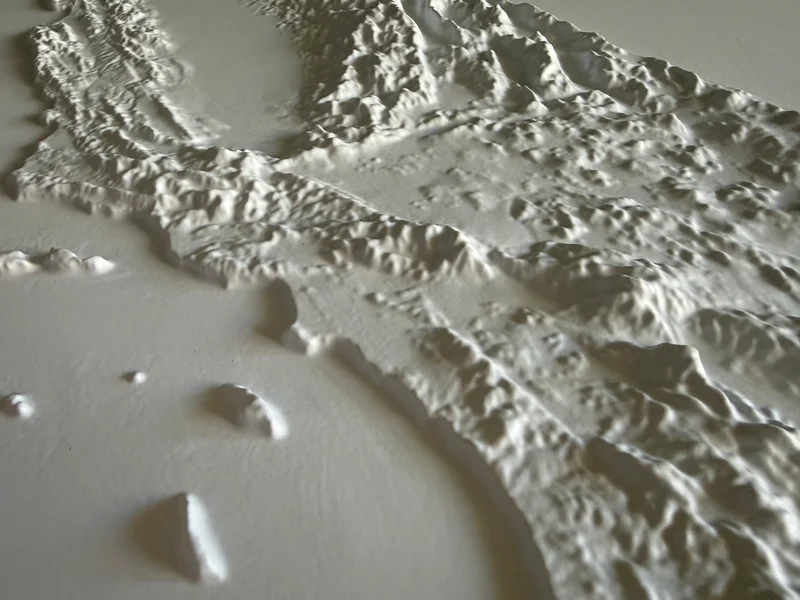
Many of the options, which include countries, states, and national parks, are based on historic map information and will evoke your memories of seventh-grade geography class, but they can also be made in pure white to go with any décor.
We bought a 3D Raised Relief Map of Muir Way's home state of California in chic pure white (24 by 30 inches, $149 without frame, pictured above) that commands the wall like modern art.
Muir-Way.com, 858/609-9047
East of Nowhere
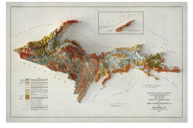
For a textured look that will be easy to frame, East of Nowhere, based in upstate New York, puts out a series of well-chosen and attractive maps that are expertly shaded to trick the eye into thinking they're 3D, but they're actually flat.
The range of options spans national parks, islands, states, popular hiking trails, and countries worldwide. Each map typically costs $159.
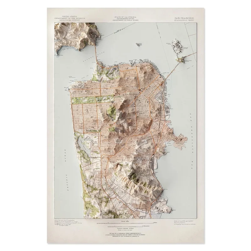
According to the company, "Each map is designed and manufactured in the USA by a founder who is a PhD geologist and has spent years mapping real landscapes in the field. That background matters. We work from actual terrain and elevation data, not templates or stock artwork, and every design is built to reflect the true character of the place it represents."
StreetCarvings
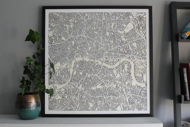
Toronto-based StreetCarvings renders maps of great cities around the world as delicate, preframed webs (generally US$170). Lasers are used to precisely carve "three layers of cut MDF [medium-density fiberboard] (3mm depth each) representing the streets, land, and water," bound together as a single flat unit measuring 28 inches square.
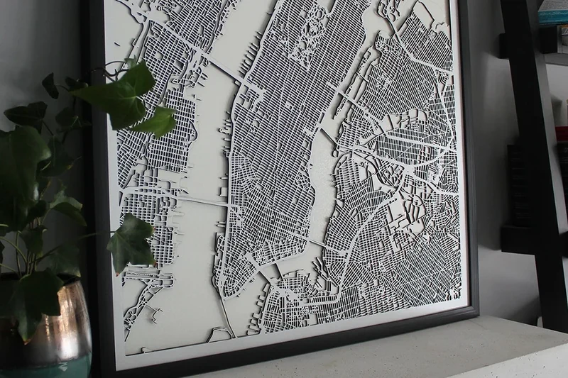
For the same concept, but in wood with some colored elements and a higher price point, check out CityWood.
Alpen-Werk
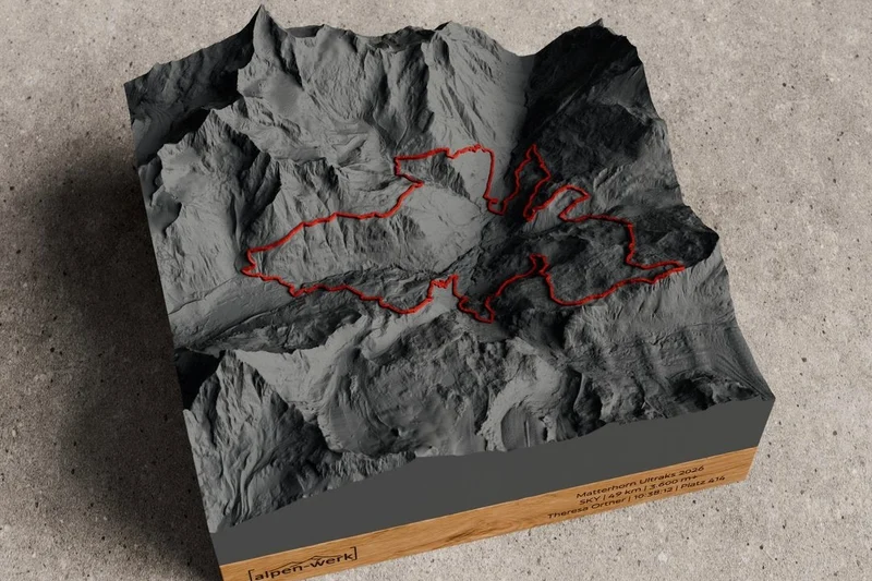
Made to commemorate conquests by intrepid hikers, Alpen-Werk 3D-prints actual mountain "topography accurate to the millimeter" set in a handmade, sustainable wooden frame of German oak or Austrian pine ($88–$263, depending on size).
You can have one made either for your desk or your wall, and you can even add the real-life path you took by uploading your GPX history file from the location-tracking app you used during your hike.
Alpen-Werk specializes in the Chiemgau region of Upper Bavaria, Germany, but is expanding to international mountain ranges.
Lord of Maps
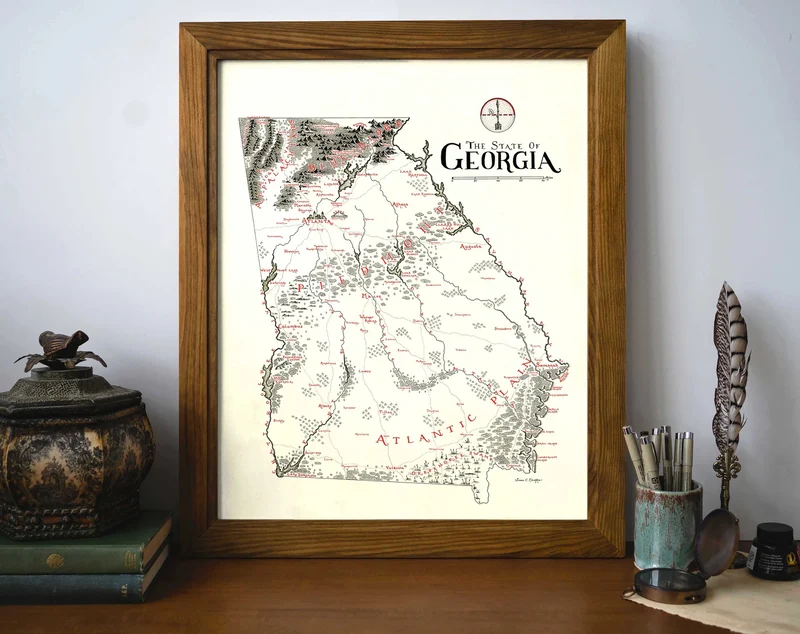
For hand-drawn maps worthy of your walls or the endpapers of a trilogy of fantasy books, Lord of Maps makes familiar places appear alluringly mythical.
The illustrations are the work of an individual artist, Isaac Christian Dushku of Utah. He supports his young family by creating these maps ($40)—there are more than 80 so far— as well as cards ($20) and books.
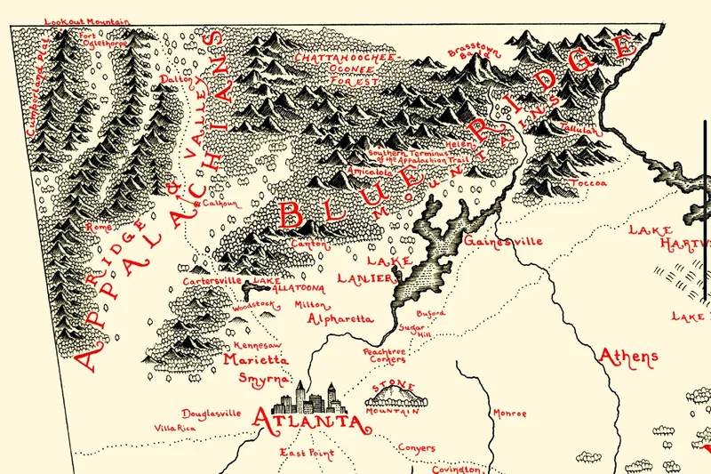
"Give me a map that is raw and wriggling," Dushku writes. "Something that has real soul put into it. Something that takes me, not just to the places depicted, to other worlds, different times."
Stephen Wiltshire Prints
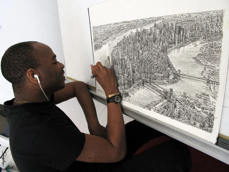
For more depictions of famous places that could only be created via a singular vision, London-based Stephen Wiltshire is an astonishingly gifted illustrator.
Born with autism and a photographic memory, Wiltshire has the power to re-create complex panoramas with meticulous accuracy—all angles, windows, perspectives, and proportions correct—after only a few seconds of looking out the window of a helicopter or observation platform.
Although Wiltshire's original works are prized by collectors and can fetch tens of thousands of dollars, prints of some of his drawings can be had for as little as £50 ($66).
ThePhoenixFactory
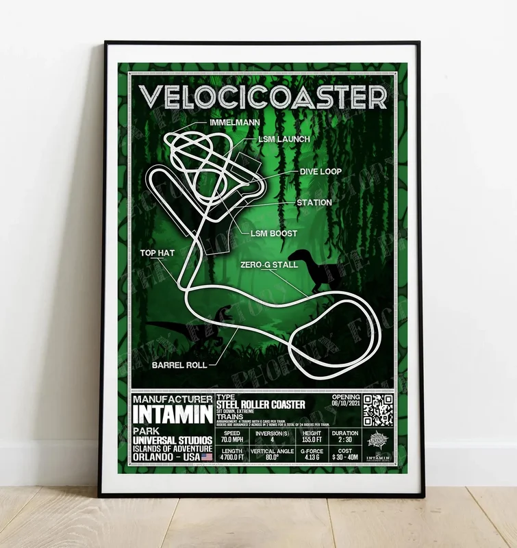
For fans of the world's best amusement parks, ThePhoenixFactory has created a series of themed posters depicting maps of a different sort: the layouts of about 100 popular roller coasters.
Each poster (less than $15 each) depicts the ride path of the highest-ranking coasters of the past (X2, Kingda Ka) and present (Falcon's Flight, Steel Vengeance), and includes pertinent statistics plus a QR code that leads to the ride's entry page on the Roller Coaster DataBase.
Art of Altitude
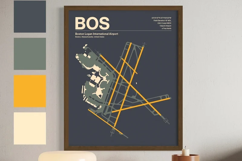
The Art of Altitude's deftly designed diagrams of the world's busiest airports are sizable enough (12 inches by 18 inches ranging to 24 by 36 inches; $29–$49) to have room for all the darts you will want to throw at the maps after a hard day's travel, and they're durable enough to withstand any withering glares, too.
Each aerial view of runways and terminals has been crafted "from published aviation charts, public aerodrome data, and OpenStreetMap vectors"—not by AI. Choose from a variety of carefully chosen color palettes to help soothe any travel trauma these airfields have inflicted on you.
These posters are also good for providing eye-catching, travel-themed décor that your friends will comment on.