Natalia Bratslavsky / Shutterstock
Memphis Travel Guide
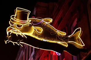
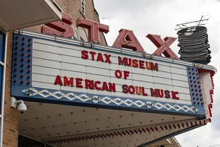
Like the Mississippi River it overlooks, Memphis is constantly evolving and changing pace. It is the city of Graceland, Elvis Presley's over-the-top mansion, but it's also the birthplace of blues, rock 'n' roll and soul. Here, W. C. Handy put the first written blues music down on paper, Elvis made his first recording at Sun Studios, and Otis Redding and Al Green expressed the music in their souls, vividly documented at the Memphis Rock 'n' Soul Museum. Slip on your blue suede shoes and hit the laid-back streets.
Things to Do
Elvis Presley sites are a must-see in Memphis, and if a home is a man's castle, Graceland was The King's. Glimpse the graceful charm of pre-Civil War society at the Hunt-Phelan mansion, and ponder the slave trade at the Auction Square monument. The lush oasis of Overton Park, where the city picnics and plays, is also home to the Memphis Zoo, the Memphis College of Art, and the Brooks Museum of Art.
Shopping
Shopping in Memphis is spread out, but unique discoveries abound, such as antiques and collectibles in the Cooper-Young neighborhood and designer labels in Grove Park. Take home blues CDs from the record shops on Beale Street or rummage through a goldmine of music at Shangra-La Records, a Memphis institution. Pick up a pair of Elvis shades at the Sun Studio gift shop. You'll find paintings and photography by artists from the Mississippi Delta, plus baby gifts and home decor, in South Main Historic District.
Nightlife and Entertainment
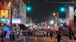
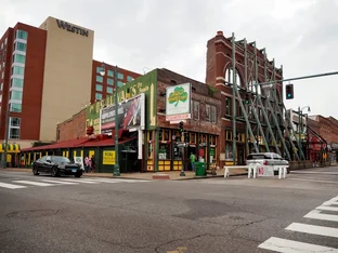
Smoky jazz, blues and country bars line famous Beale Street, the home of the blues, especially at B.B. King's, where the legendary guitarist plays several times each year. Away from Beale Street, sip a cocktail and watch the sunset over the Mississippi from the rooftop garden of the Madison Hotel, or take in an opera or Broadway musical at the Orpheum Theatre. Don't overlook the surprisingly lively bar scene in East Memphis steakhouses
.
Restaurants and Dining
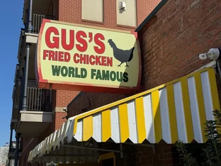
Eating in Memphis is to experience some serious Southern comfort, and the slow-cooked, pulled-pork sandwiches served at the landmark Corky's Bar-B-Q are a favorite. Try traditional fried chicken, catfish and grits. Downtown, dine al fresco on anything from sushi to tapas in Cooper-Young, or seek out tacos along Summer Avenue. White tablecloth dining -- think steak -- is best in East Memphis, and for something more casual, choose among a cluster of welcoming little eateries around the square in Collierville.