


You’ll find tourist information desks with helpful folks in purple jackets in all three terminals at Sky Harbor Airport. The city’s main visitor center, the Greater Phoenix Convention & Visitors Bureau, is at 125 N. Second St., Ste. 120 (www.visitphoenix.com; tel. 877/225-5749; Monday–Friday 8am–5pm), across from the main entrance of the Hyatt Regency in downtown Phoenix.
If you’re staying in Scottsdale, you can get information at the Scottsdale Tourist Information Center (www.experiencescottsdale.com; tel. 800/782-1117; Monday–Saturday 9am–6pm, Sunday 10am–5pm), located in the food court of Scottsdale Fashion Square, the mall on the northwest corner of Camelback and Scottsdale roads. Main Arteries & Streets
AZ Loop 101 forms a loop around the east, north, and west sides of the Valley, providing freeway access to Scottsdale from I-17 on the north side of Phoenix and from U.S. 60 in Tempe.
I-17 (Black Canyon Fwy.), which connects Phoenix with Flagstaff, is the city's main north-south freeway. This freeway curves to the east just south of downtown (where it is renamed the Maricopa Fwy. and merges with I-10). I-10, which connects Phoenix with Los Angeles and Tucson, is called the Papago Freeway on the west side of the Valley and as it passes north of downtown; as it curves around to pass to the west and south of the airport, it merges with I-17 and is renamed the Maricopa Freeway. At Tempe, this freeway curves to the south and heads out of the Valley.
North of the airport, Ariz. 202 (Red Mountain Fwy.) heads east from I-10 and passes along the north side of Tempe, providing access to downtown Tempe, Arizona State University, Mesa, and Scottsdale (via U.S. Loop 101). On the east side of the airport, Ariz. 143 (Hohokam Expwy.) connects Ariz. 202 with I-10.
At the interchange of I-10 and Ariz. 202, northwest of Sky Harbor Airport, Ariz. 51 (Piestewa Fwy.) heads north through the center of Phoenix to U.S. Loop 101 and is the best north-south route in the city.
South of the airport off I-10, U.S. 60 (Superstition Fwy.) heads east to Tempe, Chandler, Mesa, and Gilbert. AZ Loop 101 leads north from U.S. 60 (and Ariz. 202) through Scottsdale and across the north side of Phoenix to connect with I-17. U.S. 60 and AZ Loop 101 provide the best route from the airport to the Scottsdale resorts. AZ Loop 101 also heads south through Chandler to connect with I-10. This section is called the Price Freeway. The section of this freeway north through Scottsdale is called the Pima Freeway.
Secondary highways in the Valley include the Beeline Highway (Ariz. 87), which starts at the east end of Ariz. 202 (Red Mountain Fwy.) in Mesa and leads to Payson, and Grand Avenue (U.S. 60), which starts downtown and leads west to Sun City and Wickenburg.
Phoenix and the surrounding cities of Mesa, Tempe, Scottsdale, and Chandler, and even those cities farther out in the Valley, are laid out in a grid pattern with major avenues and roads about every mile. For traveling east to west across Phoenix, your best choices (other than the above-mentioned freeways) are Camelback, Indian School, and McDowell roads. For traveling north and south, 44th Street, 24th Street, and Central Avenue are good choices. Hayden Road is a north-south alternative to Scottsdale Road, which gets jammed at rush hours.
Finding an Address
Central Avenue, which runs north to south through downtown Phoenix, is the starting point for all east-and-west street numbering. Washington Street is the starting point for north and south numbering. North-to-south numbered streets are to be found on the east side of the city, while north-to-south numbered avenues will be found on the west. For the most part, street numbers advance by 100 with each block. Odd-numbered addresses are on the south and east sides of streets, while even-numbered addresses are on the north and west sides of streets.
For example, if you're looking for 4454 E. Camelback Rd., you'll find it 44 blocks east of Central Avenue between 44th and 45th streets on the north side of the street. If you're looking for 2905 N. 35th Ave., you'll find it 35 blocks west of Central Avenue and 29 blocks north of Washington Street on the east side of the street. Just for general reference, Camelback Road marks the 5000 block north. Also, whenever you're getting directions, ask for the cross street closest to where you're going. Street numbers can be hard to spot when you're driving past at 45 mph.
A Name Change -- In 2003, the official name of Phoenix's Squaw Peak was changed to Piestewa Peak (pronounced Pie-ess-too-uh) to honor Pfc. Lori Ann Piestewa, a member of the Hopi tribe and the first female soldier killed in the Iraq War. The peak in north Phoenix has long been a popular hiking destination. If you hear people referring to both Squaw Peak and Piestewa Peak, it's one and the same place. Ditto for the Squaw Peak Parkway, which is now Piestewa Freeway.
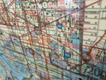
Street Maps
The street maps handed out by rental-car companies may be good for general navigation around the city, but they are almost useless for finding a particular address if it is not on a major arterial; so as soon as you can, stop at a minimart and buy a Phoenix map. Unfortunately, you'll probably also have to buy a separate Scottsdale map. Alternatively, if you are a member of AAA, you can get a good Phoenix map before you leave home. You can also get a simple map at the airport tourist information desks or at the downtown visitor center. However, your best bet these days is to rent a car with a navigation system, or bring your own with you.
Note: This information was accurate when it was published, but can change without notice. Please be sure to confirm all rates and details directly with the companies in question before planning your trip.