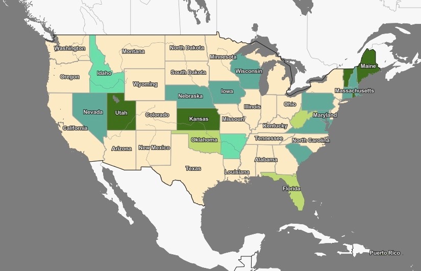
We need to give a big thank you to the National Governors Association. It just created an interactive map, the Covid-19 State and Territory Actions Tracker (pictured above in a screenshot).
The free new tool makes summer road trips much easier. It shows, at a glance, the policies in any state you might be visiting.
For example, those who might be driving into Maine, Rhode Island, Kansas, or Utah should be ready to park for a while: The tool reveals that all four states have mandatory quarantine periods for out-of-state travelers.
The map forewarns travelers heading to Maryland, New Mexico, Michigan, and several other states that they will need to pack masks to remain on the right side of the law. Likewise, mask-free states (where usage is "recommended" but not required, according to the tool) include Texas, Wisconsin, the Carolinas, and nine others.
Statewide curfews are covered, but not local ones. Still, all the info is up-to-date and hugely helpful.
You can find it on the NGA website, linked right here—but be patient. It's a slow loader, but it works.
You might wonder if someone has done the same thing for the nations of the world. Someone has—and you can find an interactive world map here.


