StockPhotoAstur / Shutterstock
Los Picos de Europa Travel Guide
Potes: 114km (71 miles) W of Santander, 398km (247 miles) N of Madrid. Cangas de Onís: 147km (91 miles) W of Santander, 419km (260 miles) N of Madrid
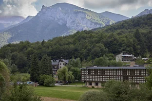
If you drive from León, your first sight of these magical mountains may well be a rainbow arching over the ridges. As part of the Cordillera Cantábrica on the northern Spanish coast, they block the moisture rolling in off the Bay of Biscay. The moisture falls as rain on the green countryside, and between the mists, the greenery, and the rainbows, one might almost expect to see unicorns.
The wildlife isn’t quite that rare, but these mountains are the last refuge for some unusual creatures. On the beech–covered slopes and in gorges laden with jasmine, you might spot the increasingly rare Asturcón, a shaggy, rather chubby wild horse so small it first looks like a toy pony. Another elusive and endangered species here is the Iberian brown bear. The park is also home to the sure–footed chamois goat, rare butterflies, peregrine falcons, buzzards, and golden eagles. All wildlife is strictly protected by the government.
Los Picos de Europa are the most famous and most legend–riddled mountains in Spain. Rising more than 2,590m (8,500 ft.), they are not high by alpine standards, but their proximity to the sea and sheer vertical drop makes their height all the more impressive. Romans constructed a north–south road whose stones are still visible in some places, but during the Middle Ages, the mountains were passable only with great difficulty. The abundance of wildlife, dramatic rocky heights, and the medieval battles that took place in the hills all contribute to the legends and myths of the principality of Asturias.
If you hike in this region, be prepared. Many slopes are covered with loosely compacted shale, so good hiking boots are essential. Inexperienced hikers should stick to well–established paths. In summer, the weather can get hot and humid, and sudden downpours sweeping in from the coastline are common in any season. Hiking is not recommended between October and May.
The best way to see this region is by car. Most drivers arrive in the region on the N-621 highway, heading southwest from Santander, or on the same highway northeast from the cities of north–central Spain (especially León and Valladolid). This highway connects many of the region’s best vistas in a straight line. It also defines the region’s eastern boundary. If you’re driving east from Oviedo, you’ll take the N-632, coming first to Cangas de Onís.
Bus travel is much less convenient but possible if you have lots of time. The best bet for planning these irregular itineraries is the website Rome2Rio.com. The region’s tourist hubs are the towns of Panes and Potes; both have bus service from Santander (two buses per day in summer, one per day in winter) and León (one bus per day in summer). The same buses serve Panes and Potes from the coastal town of Unquera. From Oviedo, there are two buses daily to the district’s easternmost town of Cangas de Onís; they continue a short distance farther southeast to Covadonga. Within the region, a small local bus runs once a day along the northern rim of the Picos, connecting Cangas de Onís with Las Arenas. The schedule , however, is erratic.