Things To Do in Kings County
Bookstore

Available as paperback
and as e-book.
Kings County Attractions
Visiting Murray River & Murray Harbour
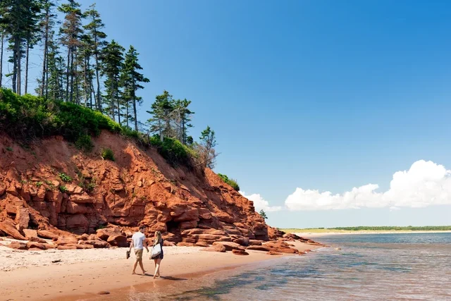
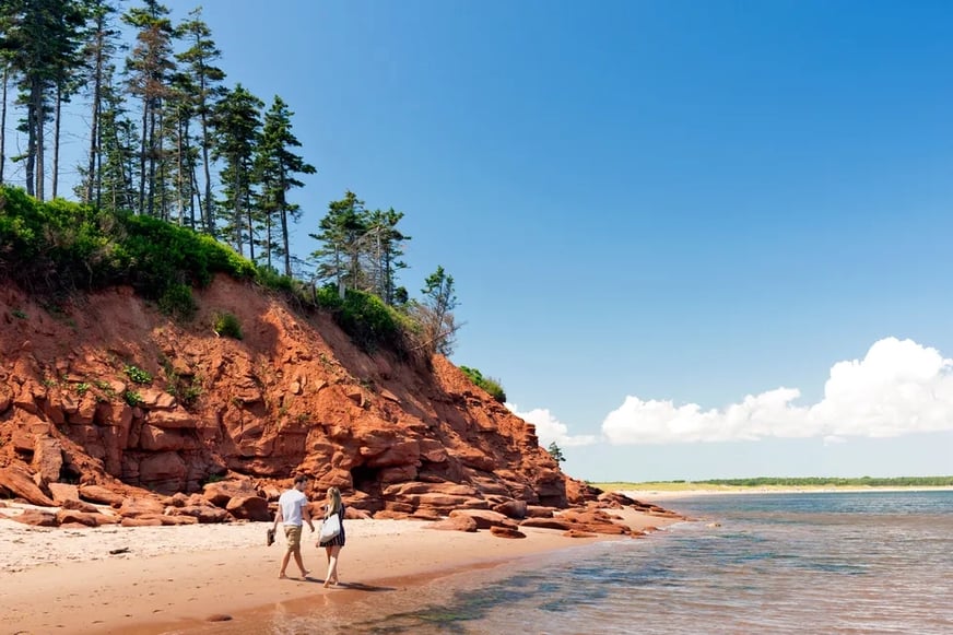
It's not too hard to guess the name of the family that originally settled this area -- it seems that "Murray" is appended to practically every landmark of note. These two small and tidy villages offer little in the way of drama but lots of repose: the sounds of crickets, wind in the trees, and water; the soothing sights of red cliffs of sand, little boats returning to harbor, and seals.
Assuming you are starting your drive to this area from Charlottetown on Route 1, you’ll soon find yourself tempted to leave the main road to explore treasures like the 1845 Point Prim Lighthouse (tel. 902/659-2768), the only round, brick lighthouse on the island, now a historic site (open daily July to mid-Sept, 10am–6pm). Follow Route 1 to the ferry terminal, turning left just before the compound, to get to the Wood Islands Lighthouse and Museum. A sweet little park here provides a photo-op of ferries and the shoreline of Northumberland Strait.
Leaving Wood Islands, watch for Route 4 and turn east. This beautiful drive takes you 9km (5.5 miles) on Route 4 to Rossignol Estate Winery. Bearing right on Route 18, watch for the signs to Cape Bear Lighthouse & Museum (tel. 902/962-2917; open June–Sept 10am–6pm). Built in 1881 on a (crumbling) cliff on the island’s southeastern-most tip, it was one of Marconi's wireless stations—and the one where an operator first heard the Titanic’s desperate SOS calls. The lighthouse was later used to track German U-boats during World War II. A small seasonal museum documents the station, which is no longer here, and it includes audio from Thomas Bartlett, the man who received the Titanic call. You can also climb about 40 steps to get a great view of the red-sand beaches and cliffs off the point. Continue on to Beach Point beach, a quiet stretch of sand especially good for families with kids. When the tide is out, there’s room to roam and tide pools aplenty.
As you drive, watch for the tight lines of buoys in the coastal waterways: The island's famous blue mussels are cultivated in the rivers here in mesh bags suspended underwater from ropes attached to those buoys, then shipped out to fine kitchens worldwide when they've grown to proper eating size.
Murray River has several natural attractions beyond the views. One short interpretive trail, about half a kilometer (a mile) long, skirts the local golf course; another trail takes you through a grove of tall, ancient pine trees on the east side of McLure's Pond.
But the town is probably more famous for its local harbor seals, which are more common than cows in this part of PEI.
Young children often enjoy corny Kings Castle Provincial Park (tel. 902/962-7422), an old-fashioned kiddy park of the sort that was popular in the 1950s and 1960s. This pleasant spot on the shores of the Murray River (with swimming at a small beach) features life-sized depictions of storybook characters scattered about the fields and woodlands. Kids can visit and be photographed with the likes of Goldilocks and the Three Little Pigs, then play on an array of playground equipment or eat ice cream at the park's canteen. It's open daily from 9am to 9pm from June through mid-September; best of all, admission is free. The park is on Route 348, about 3km (2 miles) east of the town of Murray River on the south bank of the river.
A couple of beaches are also well worth visiting if you're in the area. A short drive from Murray River along the north bank of the river (take Route 17) is remote, empty Poverty Point Beach. Dunes back this long strand of eastward-facing beach. You park at the end of the road and walk along the beach watching for bird life. Swimming is problematic, though; the beach is pebbly at low tide, and currents can be troublesome. But it's certainly quiet: You might not see another soul, even in summer, on the entire strand. It's free.
Even better is the quiet strand at Beach Point, on the south side of the river; take Route 18 east (also known locally as Cape Bear Rd.) from Murray Harbour. It's only about 3km (2 miles) to the beach, which is almost never crowded and is especially good for families with kids. When the tide's out, there's room to roam and tide pools aplenty.
A few miles north past Poverty Beach (and also free of charge) is Panmure Island and its provincial park, which is open from early June through the middle of September. This island is connected to the mainland via a sand-dune isthmus; the contrast between the white sands (on the ocean side) and the red beach of the inner cove is striking. It's a lovely spot, with swimming on the ocean side (lifeguards in summer); bathrooms and changing rooms; a viewing tower; and views northward to a striking little lighthouse. Warning: If you see a lot of broken seashells on the road, drive with care. Seagulls drop clams and other shellfish from high in the air, to break open their dinner. The largest of those shells can puncture a tire.
If you’re in Murray River at the end of July, don’t miss the Northumberland Fisheries Festival, a very local fest of dory-rowing competitions, log-rolling, and a parade for more than 40 years.
Visiting Montague and Its Surrounding Area
Montague may be the Kings County region’s main commercial hub, but it’s a hub in pretty low gear: compact and attractive, with a handsome business district on a pair of flanking hills sloping down to a bridge across the Montague River. Shipbuilding was the economic mainstay in the 19th century; today, though, fishing, dairy, and farming are the primary local endeavors. Montague has a lovely little waterfront on the river where you can enjoy refreshments overlooking the marina. In the center of the town is a government-sponsored outdoor gallery of murals and sculptures. Next to the bridge over the river near the marina, you’ll see three giant black cormorants, each in a different stance atop a 15-foot pole. On the other side of the river from the cormorant sculptures is a cooperative art gallery called Artisans Waterfront (tel. 902/838-4387). Inside, are works by painters, rug hookers, quilters, and many other types of craftspeople. Usually, an artist is at work while others take their turn tending the bright, new shop full of fine arts and high-quality crafts.
East of Montague at Three Rivers, the Roma National Historic Site (tel. 902/838-3413) brings to life the story of a French merchant who, in 1732, established an international trading post. The site has lively interpretive events, a heritage garden, a set of reproductions of period buildings, and offers an old-fashioned lunch of baked beans and fishcakes in their on-site café, which comes with bread baked in Roma’s outdoor oven. Buy a loaf to go—it’s delicious. The park is open daily late June to late September, 11am to 5pm. Admission is C$6 adult, free for children under 6, and C$18 for a family of four.
Southeast of Montague (en route to Murray River) is Buffaloland Park (tel. 902/652-8950), home to a herd of buffalo. A gift from the province of Alberta, the magnificent animals number more than 50 since Buddhists took over the operation a few years ago and no longer cull the herd. Walk down the fenced-in corridor and ascend the platform for the best view. Often, they’re hunkered down at the far end of the meadow, but be patient; they sometimes wander closer. The park is right off Route 4, about 6km (4 miles) outside town; watch for signs. Like so many PEI parks, it’s free.
A bit north of Buffaloland on Route 4, between routes 216 and 317, is the Harvey Moore Wildlife Management Area, a delightful place for a stroll. A privately owned park named for the naturalist who created this sanctuary in 1949, its centerpiece is a 45-minute trail that loops around a pond and through varied forest and across fields. Watch for waterfowl (with which Moore had an unusually close rapport) such as black ducks, blue-winged teal, ring-necked ducks, pintails, and plenty of Canada geese. Open during daylight hours June to mid-September. Once again, admission is free.
Brudenell River Provincial Park (tel. 800/463-4734) is one of the province’s best parks and the largest in eastern PEI. You’ll find two well-regarded championship golf courses, an executive course, a resort, tennis, lawn bowling, a playground, a campground, and nature trails. There are also interpretive programs for kids and adults. Visitors can ride horses and rent canoes, kayaks, and jet skis from private operators within the park, which is open daily from mid-May through early October, and is free to enter. To reach it, head north of Montague on Route 4, then east on Route 3 to the park signs.
Visiting Souris & Northeast Prince Edward Island
Some 40km (25 miles) northeast of Montague -- take Route 4 north out of town, merge with Route 2, and keep going east -- is the little town of Souris, an active fishing town attractively set on a gentle hill overlooking its harbor. Yet things weren't always so great here. Souris (pronounced soo-ree) is actually French for "mice" -- not too flattering, is it? And, in fact, the town owes its name to its frustrated early settlers, who were beset by waves of voracious field mice that repeatedly destroyed their food crops. Finally they named the place "Mouse-town" and concentrated on the fishing, which worked out rather better. But "Mouse-town" it remains today, though the mice are (mostly) gone.
In addition to its own little charms, this town is the launching base for ferry boats to the Magdalen Islands.
It also makes a good central base for exploring northeastern PEI, which is considered by many to be the island's version of the Outback or Maine's North Woods -- a place that's remote, barely populated, and (in this case) more greenly forested than the rest of PEI. Since a spur of the Confederation Trail ends in Souris, this is a good spot from which to launch a bike excursion of the area. You can ride to the main trunk trail, then turn northeast and continue to land's end at the East Point Lighthouse.
Several good beaches can be found ringing this wedge-shaped peninsula that points toward Nova Scotia’s Cape Breton Island. In addition to Souris Beach, which you cross heading east on Route 2 to enter town, Red Point Provincial Park (tel. 902/357-3075) lies about 13km (8 miles) northeast of Souris, on Route 16. Open from June through mid-September, it offers a handsome beach and supervised swimming, along with a campground that’s popular with families.
Farther along Route 16, there’s another inviting beach at Basin Head, which features “singing sands” that allegedly sing (actually, they squeak) when you walk on them. The dunes are especially nice. Access is via the Basin Head Fisheries Museum (tel. 902/357-7233) C$7 adults, C$6 seniors and students, children under 4 free, C$20 families (2 adults, 2 children); daily July and Aug 9:30am to 5pm, weekdays June and September. The provincially operated museum offers insight into the history of inshore fishing with small wooden boats and a cannery to tour.
At the island’s far eastern tip is the aptly named East Point Lighthouse (tel. 902/357-2106) C$6.90 adults, C$5.75 seniors, C$4.60 students, C$2.30 children ages 3 to 5, C$17.25 families (parents and all dependent children); open late May to late Sept. You can simply enjoy the dramatic setting with the octagonal, shingled lighthouse and lightkeeper’s cottage overlooking the sometimes turbulent meeting of the tides; or take a tour of the lighthouse from June through early September. Ask for your East Point ribbon while you’re here; if you also made it to the North Cape Lighthouse on PEI’s western shore, you’ll receive a certificate saying you’ve traveled the island tip-to-tip. There’s also a craft shop on-site selling jewelry, soap, sand paintings, local books and music, and other island goods.
East Point to Mount Stewart, Including St. Peters Bay
The easternmost sector of Kings County attracts few tourists -- other than those speeding through en route to East Point with the goal of a tip-to-tip car crossing of the island.
Yet it's worth slowing down to see this region -- the pastoral landscapes are sublime, and the best vistas are found off the paved roads. It's also an area blessed with a number of appealing bike routes and what might be the island's top golf course. While it has few prominent natural landmarks, St. Peters Bay, a narrow and attractive inlet that twists eastward from the coast, is a worthy exception -- one of my favorite little bodies of water on the island, for some reason. This is also the real PEI: full-service filling stations that look like they could be straight out of the Midwestern U.S. in the 1950s; farmers cycling and fishing from bridges; bold purple lupines far outnumbering cows, cars, and people.
Follow Route 313 along the north shore of St. Peter's Bay to its tip and you'll come to the Greenwich Dunes Trail, a stunning area of uniquely wind-carved migrating sand dunes capped with grasses. This region was slated for vacation-home development until 1997, when it was acquired (and thus saved) by Parks Canada, which added it as an extension to Prince Edward Island National Park. Thank goodness for that.
The cute little town of Mount Stewart (on Rte. 2, just over the county line in Queens County) is located near the confluence of several spurs of the Confederation Trail, the excellent island-wide recreation trail. The Mount Stewart area is home to some of the best-maintained eastern segments of this trail.
A collection of shops are next to the bridge at the head of the bay called St. Peters Landing; enjoy an ice cream or a coffee, pick up some fresh fish, or browse gift shops. The Turret Bell (tel. 902/961-3273) at 5707 St. Peters Rd. is a fun spot to find a book or local island music. Artisans run a pewter shop, St. Peters Bay Craft and Giftware (tel. 902/367-7900) nearby at 15465 Northside Rd., where you can even learn to pour your own piece of pewter.