Doraemonz32 / Shutterstock
Bangkok Travel Guide
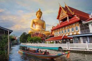
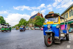
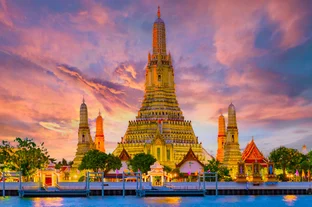
With its intense humidity, hedonistic nightclubs, and hurly-burly taxiing of tuk-tuks, Bangkok is an exhilarating attack on the senses. Sukhomvit's malls and gleaming skyscrapers are just a veneer of modernity for a city firmly rooted in ancient Buddhist beliefs and traditions. Watch saffron-robed monks on their morning alms rounds, clouds of incense rising above the Grand Palace's golden spires, and long-tail boats gliding along the Chao Phraya River at dusk to discover Bangkok's underlying sense of calm and the spirit of old Siam.
Things to Do
Open-air massage and fresh coconut juice between temples keeps you cool and calm when sightseeing in Bangkok. Arrive early and dress modestly to seek out the dazzlingly intricate Grand Palace's sacred Emerald Buddha and neighboring Wat Pho's 46-meter-long Reclining Buddha. Families send colorful dragon kites soaring at the nearby Sanam Luang square, while locals practice morning tai chi in lake-dotted Lumpini Park. Take a long-tail boat along the Chao Phraya River as the setting sun silhouettes palace spires and bell-shaped stupas.
Shopping
Aromatic spices, fighting cocks, and every Thai craft imaginable attract shoppers and people-watchers to the 15,000-stall Chatuchak Weekend Market. Rise early to explore the market at its coolest and be prepared for good-humored haggling. Monks in flowing robes drift through atmospheric Amulet Market near the Grand Palace, while locals forage for wholesale food in labyrinthine Chinatown. Sukhumvit's shiny malls and boutiques are the go-to place for designer fashion, leather, and a tailor-made silk outfit from Jim Thompson.
Nightlife and Entertainment
Elephants parade past party-mad clubbers and tuk-tuks dart through crowds on neon-lit Khao San Road, where anything goes in the pulsating bars and live music joints. Go-go girls perform in hedonistic Patpong and Soi Cowboy, but few have the supermodel figures to rival the transgender performers at Calypso Cabaret. Silom and Sukhumvit are packed with clubs and cocktail bars, like the 61st-floor Vertigo Bar with its dazzling view of twinkling Bangkok.
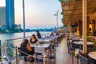
Restaurants and Dining
With cooks juggling woks on every corner, Bangkok is all about grazing for street food. Backpackers head for food stalls in Banglamphu's narrow sois, where a few baht buys a sticky pad thai or spicy papaya salad. Choose the Phahurat Indian quarter's teahouses for authentic biryanis and curries or buzzy Chinatown for noodles stir-fried to perfection. The Skytrain speeds you to high-rise Sukhumvit and Silom, where expats and dressy locals go for global cuisine from Middle Eastern to Italian.